Intelligent Lunar Prospecting
Developing intelligent prospecting algorithms for lunar rover missions under an Australian Space Agency Moon to Mars Feasibility grant, enabling efficient resource exploration on the lunar surface.
The Challenge
Future lunar missions will need to locate and characterise resources like water ice before establishing permanent bases. However, communication delays between Earth and the Moon (up to 3 seconds round-trip) make real-time teleoperation impractical. Rovers must make intelligent decisions about where to sample and how to efficiently explore large areas with limited time and energy.
The challenge was to develop algorithms that could guide a rover to efficiently prospect an unknown environment, building accurate resource maps while minimising the number of samples required.
My Contribution
I was the lead author on the successful grant application and led all R&D efforts. This included:
- Algorithm development — Designing active learning algorithms that select optimal sampling locations based on current knowledge and uncertainty
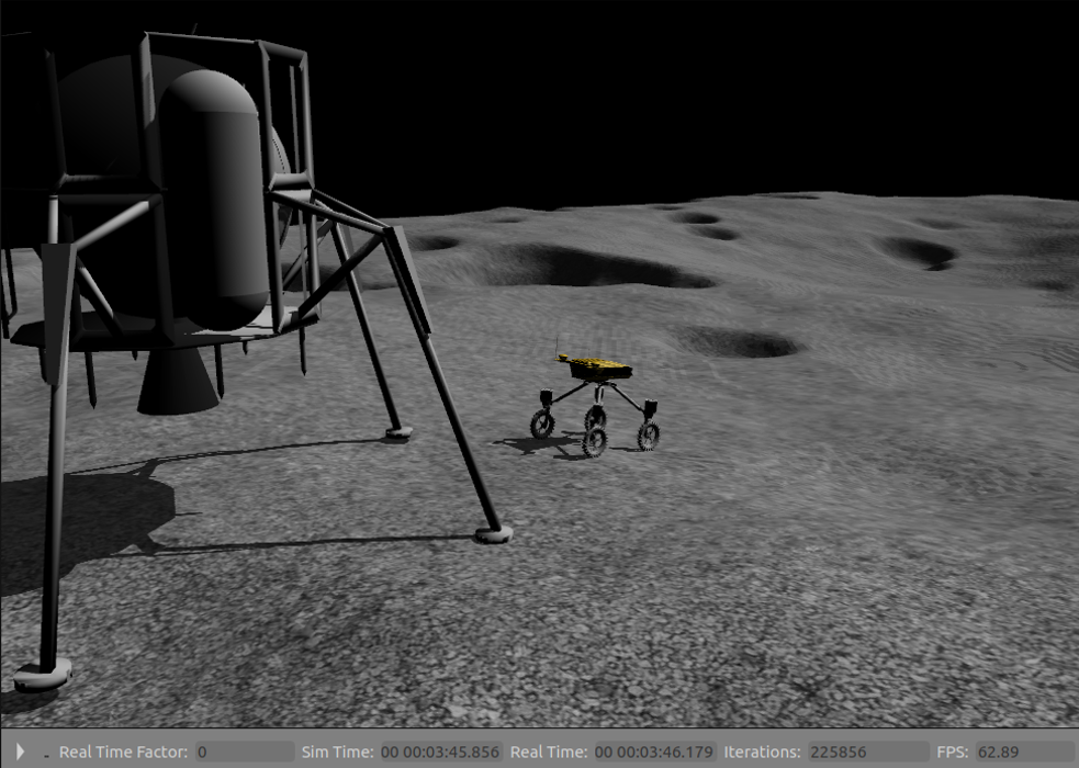
- Simulation framework — Building a digital twin of the lunar prospecting scenario for algorithm development and validation
- Perception — Real-time traversability estimation of unstructured terrain from LiDAR data.
- Field demonstration — Implementing and testing the algorithms on the Swagbot robotic platform
- Reporting — Delivering technical reports to the Australian Space Agency on developed systems and algorithms
Technical Approach
The intelligent prospecting system uses Gaussian Process models to maintain a probabilistic map of resource distribution. At each step, the algorithm selects the next sampling location that maximises expected information gain while respecting traverse constraints.
Key innovations included:
- Multi-objective optimisation balancing exploration (reducing uncertainty) and exploitation (characterising promising areas)
- Energy-aware planning ensuring the rover can always return to base
- Adaptive sampling density based on local variability
Results & Impact
The project successfully met all grant milestones and deliverables. The algorithms demonstrated significant improvements over naive sampling strategies, requiring fewer samples to achieve equivalent map accuracy.
This work laid the foundation for several subsequent projects in environmental monitoring, with the core algorithmic approaches now being applied in agricultural soil mapping, space mission planning, and other domains requiring efficient information gathering.